BC Coastal Community Eelgrass Stewardship Project
In 2002, SeaChange initiated the BC Coastal Community Eelgrass Stewardship Project, a coastwide community eelgrass mapping and monitoring training program. Over 35 coastal communities, from Haida Gwaii to Boundary Bay, were trained in eelgrass surveying from 2002-2004. Many of these communities are now mapping and monitoring eelgrass habitats as well as initiating stewardship actions.
Baseline mapping of eelgrass empowers communities to learn about and protect nearshore and estuarine habitats and enables them to identify potential eelgrass restoration sites. Our training programs are designed to advance stewardship while fitting the passions of the community and adapting to volunteer capacity. We take the lead from stewardship organizations and community members.
Saanich Inlet and Peninsula Atlas of Shorelines
For coastal communities, backshore development is affecting shoreline resiliency. The backshore can act as a dynamic barrier or a vulnerable area, depending on how it is managed. Unlike Washington State, which has a Shoreline Management Act to coordinate planning and protect the public interest in shorelines, British Columbia does not have one specific law devoted to nearshore habitat. Instead, there are different laws at the federal, provincial, and municipal levels which may play a role in habitat protection. However, municipal governments do have wide powers to create resilient coastal communities up to the high-water mark, through informed backshore land use and zoning decisions; and bylaws concerning riparian setbacks, tree removal, watercourse protection and forage fish habitat.
Our goal with the SIPAS project was to evaluate the social, economic, and ecological values along the Saanich Peninsula coastline. This mapping was first done in 2007-2009 and was done again in 2020. Data from the original mapping was compared to the updated mapping to determine significant changes. The data collected focused on shoreline hardening, locations of sensitive habitats, potential forage fish habitat, and risk to sea level rise. Notable ecological and anthropogenic changes were presented in a final report to the municipal council, mayors and staff of Sidney, Central Saanich and North Saanich. Through these partnerships, we hoped to inform future decision-making related to nearshore development, ecological damage, and sea level rise. Please click the links below for the technical reports.
SṈIDȻEȽ Educational Programs
EcoRowing and Paddling
Youth from our local schools paddled the peaceful waters of SṈIDȻEȽ (pronounced sneet-kwith), The Place of the Blue Grouse. We offered “EcoRowing” in the fall and spring months to elementary and middle school students. While paddling on the calm waters of the inlet, youth learned about hunting and fishing from this special place from a Tsartlip First Nations member. When paddlers disembarked, they explored the world of native plants of the inlet and their uses for medicines, food, and tools. During their marine science experience, they poured “pollution” on a three-dimensional model of the Tod Creek Watershed and discovered how land activities can affect water quality in the inlet. Afterwards they tested water quality from the dock and gauged the health of the waters using scientific equipment.
International Programs
SeaChange worked with the University of Victoria and Vancouver Island University to engage students from countries around the world in the cultural and ecological beauty of SṈIDȻEȽ. Day-long programs included ethnobotanical tours, watershed models and an overview of the ongoing restoration work of a special place with thousands of years of history. We are passionate about exploring the common ground that we all share as citizens of the planet.
SṈIDȻEȽ Restoration Projects
In 2000, SeaChange restored 1,800 eelgrass shoots in SṈIDȻEȽ with community and government support. Little did we know that this was the beginning of an odyssey of ecological and community restoration in the Salish Sea!
Riparian Restoration
SṈIDȻEȽ is a sacred place; our restoration work there is meant to be a deep honouring of the land. We follow the natural processes of these forest ecosystems in our decision making, taking the time to connect to the landscape and uncover the layers of stories the land holds. We emphasize the traditional food ecosystems of SṈIDȻEȽ, with sincere respect for the long and unbroken connection of W̱SÁNEĆ people to this place. Our work is informed by W̱SÁNEĆ elders, knowledge keepers and done with permission from the Tsartlip First Nation Lands Committee.
In 2006, the BC Conservation Corps employed a team of workers to establish terrestrial restoration sites in the area surrounding the inlet. From 2006 – 2010, SeaChange staff maintained these sites through school programs and volunteer restoration days. In 2010, the terrestrial restoration work was developed into a landscape level restoration plan linking all the sites together; and regular volunteer days were established to develop and expand the restoration sites. Additionally, many school programs and community groups participate annually in the restoration of these sites.
The lower sites (sites 6 and 7) reflect a mosaic of diverse forest ecosystems, leading from a coniferous edge zone (site 6a and part of 6b) to a large cottonwood (Populus balsamifera) stand (site 6b, 6c, 7a). The cottonwood stand is also mixed with early successional stage forest species such as bigleaf maple (Acer macrophyllum), red alder (Alnus rubra) and nootka rose (Rosa nutkana). Sites 8, 10 and 13 represent the ecotone of mixed deciduous and coniferous forest between the areas heavily modified by past industrial activities and the more mature, intact forest community in the eastern section of the project area. Site 13 represents very dramatically the many cultural layers that exist at SṈIDȻEȽ; its restoration had significant public appeal and provided a high visibility centerpiece for this work. Site 11 had some qualities of a moist forest being downslope from a wetland ecosystem, and the drainage areas in particular may be restored in conjunction with future wetland restoration (site 12a). Site 19 and the Chinese midden site are within the mature forest areas of SṈIDȻEȽ.
The modified soils of some of the newest restoration sites (6 & 7) presented a unique set of circumstances due to the significant amount of concrete debris littering the area. We took an active approach to soil restoration to jump start the ecological recovery in these areas through the generous application of leaf mulch to the land over the autumn and winter. We predominantly used leaves which are appropriate to the forest ecosystems of SṈIDȻEȽ; throughout the autumn, we gathered red alder and bigleaf maple leaves from the local area (with a lot of help from local residents!) and covered our sites with these leaves. These leaves nourish the soil to the correct acidity and introduce the fungal and bacterial relationships back onto the land so our planted species can thrive.
Our choices of plantings were informed by concepts of ecological resilience. Pioneer species such as alder, maple, and cottonwood grow quickly and being deciduous, provide shade for the exposed sites during the summer then drop their leaves each winter to foster the soil enrichment of the site. Pioneer species also create niche habitats which facilitate the natural regeneration of other shrub and herbaceous native species on these sites. This approach to restoration imitates the natural succession stages of ecosystems after disturbances and allows for ecosystem adaptation in the face of a changing climate.
We also discovered there are many old fruit trees throughout almost all our restoration sites at SṈIDȻEȽ, left from the era after the cement plant closed down and people lived in the staff residences (many lived here until the 1950-60s). We tended these fruit trees, most of which have not received any care for decades, regarding them as a positive remnant of a very complex and destructive piece of the history at SṈIDȻEȽ. Each restoration site at SṈIDȻEȽ has a place in the larger landscape of the inlet area and the wider bioregion outside park boundaries. Archeological remnants of the homes and buildings associated with the cement factory are the sites of the most ecological disturbance at SṈIDȻEȽ, and were the focus of our invasive plant removal efforts. Tsartlip First Nation, who hold a claim on this sacred W̱SÁNEĆ place, worked in partnernship with SeaChange to do this restoration work in ways which respect and honour the W̱SÁNEĆ connection to SṈIDȻEȽ, such as planting traditional W̱SÁNEĆ foods and medicines. Many W̱SÁNEĆ youth and community members are active participants in this restoration work and lead the vision for the future of SṈIDȻEȽ.
After eight years of intensive restoration efforts with SeaChange, the SṈIDȻEȽ Resiliency Project is shifting towards greater leadership from the W̱SÁNEĆ community by coming under the direction of the PEPÁḴEṈ HÁUTW̱ Foundation. The PEPÁḴEṈ HÁUTW̱ Foundation has done remarkable work in fostering hands on education in the fields of ecological restoration, native plants and traditional food systems.
We hope our restoration sites offer park visitors some insight into the complex history of this special place and invite a cultural exploration into the ecology of the area.

Site 6C


Site 7A


Site 7B South


Site 7B West


Site 7C Shoreline


Site 10C


Site 13


Beach Enhancement
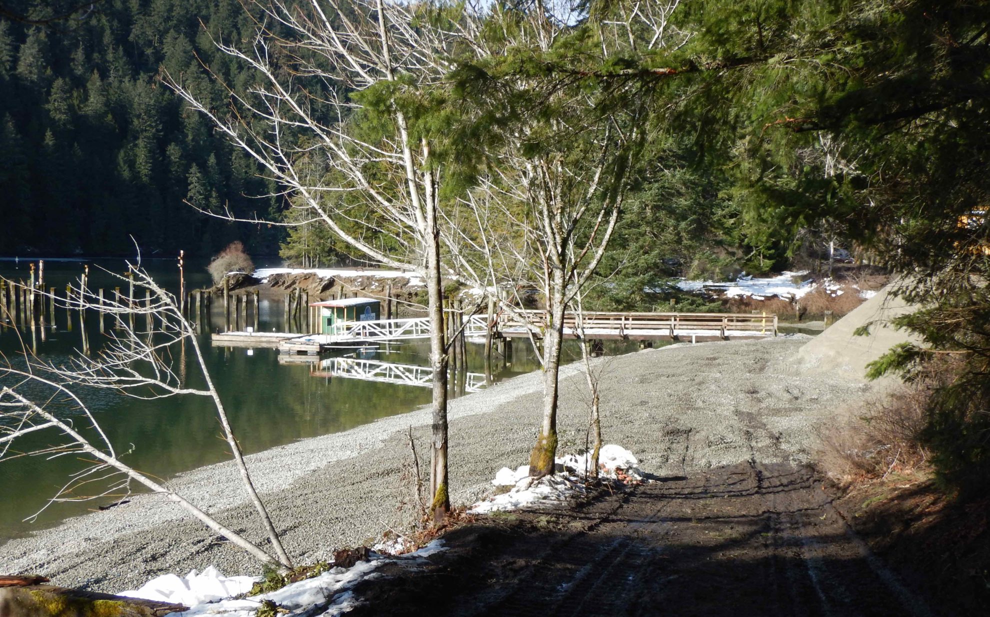
SeaChange Marine Conservation Society, in partnership with the Tsartlip First Nation and BC Parks, completed a comprehensive a beach enhancement project in SṈIDȻEȽ. The restoration site was a highly degraded unnatural shoreline. This restoration is a natural progression for shared vision of a renewal of health for the inlet. This work is part of a larger restoration project in SṈIDȻEȽ (Place of the Blue Grouse). Visitors to the area will have seen volunteers removing invasive plant species and replanting sites with the native species once found here.
The three phases of the beach enhancement project can be seen below. The method used to enhance the beach is called beach nourishment. This is a soft shore approach for low wave energy shores that allows the tides to move the gravel material rather than erode the shoreline. Finer sand material was deposited on the back shore. Logs will be placed near the slope and more native plants will be installed behind the logs. Over time, we will witness a diversity of marine life on the shore once devoid of life. As sea level increases, more of the shore will be underwater providing a different kind of habitat for fish and the life they feed upon. This is an example of resiliency and adaptation to present and future climate changes.
This work will provide erosion protection from rising sea levels and gives one example of how individual homeowners can use these “soft shoreline” techniques to protect their foreshore areas in low wave energy areas without resorting to damaging methods such as rock walls along the waterfront.
This time-lapse video footage is the story of the restoration work done on the shore of Tod Inlet (SṈIDȻEȽ) in early February, 2017. Despite snowy conditions, by the evening of February 10th, 350 cubic m and 2250 cubic m of clean sand and gravel were deposited. This was done in partnership with the Tsartlip First Nations and BC Parks to create clean surface areas and habitats for marine life and recreationists and demonstrates how the placement of sediment on the shore in areas of low wave energy can slow down the erosional effects of rising sea levels.
Walking hand in hand with First Nations and BC Parks, SeaChange is continuing the restoration of the estuary in SṈIDȻEȽ. This video made with Simon Smith Sr. and Ian Bruce tells the story of the beach enhancement project completed in 2017.
Tod Inlet Concrete Removal


Shell Hash Project
Three years of monitoring of the beach installed during the 2017 Beach Enhancement project described above showed some return of small clams, oysters, limpets and other marine life. That led to starting another stage of recovery work. In 2019, SeaChange staff consulted with the Tsartlip First Nations to receive advice about adding shell hash, or crushed shells, to further replenish the shore sediment. Once we had the approval of the W̱SÁNEĆ Nations, we started to investigate how this could be done.
Marine Debris Removal
During the winter of 2016-2017 we used SCUBA divers, lift bags, work floats, and, for the bigger debris, barge, and crane, to remove debris mapped by our summer students during the summer of 2016. This project was a partnership with Tsartlip First Nation and BC Parks and was part of a 100 Year Pan for the recovery of this special estuary. Funds for the project were from the Recreational Fisheries Conservation Partnership Program and the Pacific Salmon Foundation.
The SeaChange SCUBA dive team and RV John Strickland crew removed a total of 130.05 T of underwater debris from the estuarine marine environment of Tod Inlet to improve water quality and sediment health for recreational fish populations. The work was completed by the end of March 2017. The area of removal included the underwater environs near the entrance of the Park boundary to the mouth of Tod Creek within the inlet.
Salish Sea Nearshore Habitat Recovery Project
In 2017, SeaChange was awarded a 5-year Coastal Restoration Fund grant in the amount of $1.3 million to support the recovery of nearshore marine habitats in four regions: Gulf Islands, Howe Sound and Burrard and Sechelt Inlets. This community based project entailed native eelgrass restoration and transplanting, marine riparian restoration, and underwater debris removal from nearshore areas.

Interactive GIS Map
Click here to view the full size interactive map:
For more information see our story maps:
Chapter 1 – The story of marine restoration on Pender, Lasqueti, and Thetis Islands.
Chapter 2 – Eelgrass restoration and debris removal in Sechelt Inlet.
Nearshore Marine Habitat Assessment Project
In 2022, SeaChange Marine Conservation Society contracted with the Ministry of Environment and Climate Change Strategy to survey native eelgrass (Zostera marina) and the presence of Sargassum (introduced Japanese Wire Weed) in four Provincial Marine Parks within the Gulf Islands. The Marine Parks included Princess Cove and Conover Cove on Wallace Island, Montague Harbour on Galiano Island and Pirates Cove on De Courcy Island. Stern tie and boat mooring locations were mapped and spatial maps were created and distributed to the Islands Trust and the Ministry of Environment and Climate Change Strategy. Recommendations were included in the final report for improved eelgrass habitat protection, including suggestions for alternative locations for boat mooring and stern tie locations. This work is intended to reduce impacts from recreational boating and further improve conservation and protection of marine nearshore habitats within the Gulf Islands. SeaChange suggested conservation efforts recommended in this Report within Provincial Marine Parks be pursued in concert with community groups, such as Marine Parks Forever Society, First Nations, local conservancies, and other local organizations. See the final report below: